Cumbria
SPRING/SUMMER 2026 PROGRAMME
Our Spring/Summer programme takes us in every direction from Bolton. We venture North to Cumbria, West to Wales, East to West Yorkshire and South to Staffordshire. We climb mountains and ascend peaks, cross moors, and walk by the river and coast. Along the way we explore varied landscapes, geology, flora and fauna and local history, always with a welcome pint or brew in a local hostelry or café at the end of our travels.This month, for the first of these walks, we head North to East Cumbria.
CUMBRIA
A: Newbiggin to Appleby 12 miles, 1000ft of ascent.
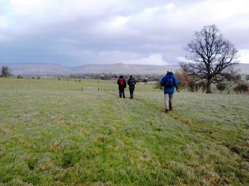
This scenic walk is far removed from the crowded paths of the Lake District and we are unlikely encounter many others on our route. We start just North of the Howgills in the beautiful Lune Valley, heading further North over Ravenstonedale Moor where we join the Dales High Way. We then continue steeply upwards onto the dramatic limestone platform of Great Asby Scar and reach our highest point of the walk at 1204ft. Heading downhill across moorland into the valley we reach the pretty village of Great Asby. It is then a gentle, pretty walk all the way to Appleby, following the meandering Hoff Beck and stopping to admire the beauty spot of Rutter Force. We turn away from the Beck to cross fields and head down into the market town of Appleby.
WALK A Link to OS map
WALK B: Warcop to Appleby 8.5 miles, 600ft of ascent.
This scenic and gentle walk incorporates two long distance footpaths - A Pennine Way and the Dales High Way as we follow the Eden valley. We start just outside the pretty village of Warcop, crossing the Eden Valley Railway, wandering through the village and then crossing the River Eden to join A Pennine Way. This broadly follows the line of the river upstream for several miles until we reach the village of Great Ormside. At this point we turn away from the river to head across fields to join the Dales High Way at Hoff Bridge over the River Hoff. We follow this for a short while before turning to head down into Appleby.
WALK B Link to OS map
WALK C: A gentle 6 mile walk on good paths with minimal ascent - details to be confirmed.
In the unlikely event of separation from the group or other emergency please take note of the following contact numbers:
Liz Moxham - 07876255849
Frank Jones - 07788736006